Map Making Evolves: Discover Mapotic’s Latest User-Driven Upgrades
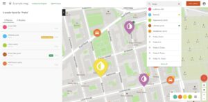
Effortless collaboration, informative place labels, and polygons to enhance your map making experience.
Effortless collaboration, informative place labels, and polygons to enhance your map making experience.
Explore alternatives to Google My Maps for custom mapping needs. This article compares top online services like Mapotic, Mapme, and MapHub.net, highlighting their unique features, from advanced categorization to mobile app integration. Discover the right tool for sophisticated map-making beyond Google’s offering
In today’s digital age, the ability to create a custom map is more than just a convenience – for many businesses and communities, it’s a
Unveil the transformative capabilities of Mapotic Live Data Maps in the realm of geospatial data visualization. Turn complex data into actionable insights. In the era
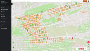
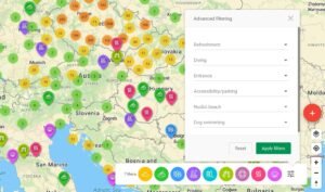
We’ve added some new features to give map administrators more superpowers to make creating custom maps even more enjoyable. Discover the latest additions to our
Are you curious about how Mapotic’s free custom map builder stands out from other mapping platforms? Look no further! In this article, we will delve
There are numerous tools out there to create custom maps, and each custom map builder is suitable for slightly different use cases. We created Mapotic mapping

Our interactive maps can serve to connect people with a common purpose in many different fields of activity. Many maps created on Mapotic also aimed

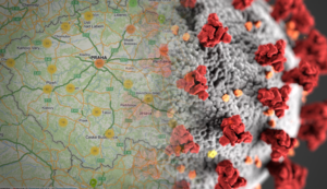
During the spring months of this year, most countries were affected by the SARS-CoV-2 coronavirus pandemic. In many countries the citizens responded very adequately, creating
V souvislosti s celosvětovou pandemií koronaviru jsme se rozhodli uvolnit komunitám a nekomerčním projektům zaměřeným na boj proti Covid-19 veškerá placená rozšíření zdarma.

New map shows the best places worth visiting in the Alps. Every place in the map includes useful information such as altitude, activities or suitability for kids.

Global Footprint Network is a global organization founded in the 1990s in the US and its mission is to fight for sustainability and track human impact on our planet. The community map project #MoveTheDay is now launching to support eco-friendly projects and network people from around the globe.
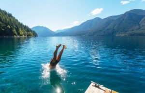
Community map Swimplaces is joining the Mapotic family. The largest database of natural swimming in the Czech Republic will have new features and will be part of mapping platform Mapotic.

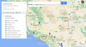
This article explains briefly the main differences between Mapotic and other map services, such as Google Maps, Google My Maps, Mapbox, CartoDB and similar.
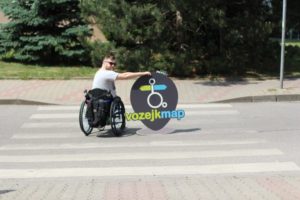
VozejkMap is a unified and easy-to-use map of barrier-free sites not only in the Czech Republic.

It’s not only about growing beautiful gardens and organic waste composting places on the map, but about community and real human connections.

There is untapped potential hidden in the geolocation data and in the new ways of using it. By simply displaying static data in a map,