

Expand your teaching methodology with new tools
Maps have magical powers. Combined with interactivity and multimedia, they can serve as a great learning tool.
Make better use of maps, rather than simply displaying information on them. Use interactive features to engage students in content creation, or use maps for data collection and project output. Maps can also be used as a tool for gamification or long-term mapping of specific areas, whether they are geographic regions or specializations within any human activity that has some relevance to location related to location.
Involve students, study groups, schools, and entire countries
Users can enter and manage data that is moderated by the main administrator
Enable the public to create content together and actively participate in the maps. For example, by adding or suggesting locations, or adding information to preexisting objects (locations, polygons, routes). In addition to geographic information, you can also add multimedia such as photos, and integrate the project with links to other services. Maps can also be freely embedded into existing websites or applications.
Integrate scientific data and use different map layers
Easily set up any content structure, data, and map layers
You can easily import your existing data into Mapotic through Excel or Google Sheets. Additionally, you can connect your map project to an existing API and sync data from the internet or IoT devices. You can set up any data structure and map base for your map content to suit the exact nature of your project. Based on this, filters and categories are created, allowing users to navigate the maps easily.
Education tools
for the 21st century
Help students thrive doing something they enjoy, while learning at the same time.

Make your data useful for scientists
Build both one-off and long-term mapping projects
Mapotic can be used for a short-term mapping event, but also as a long-term research or awareness-raising project
For example, Mapotic can be used for one-off coursework, or as long-term projects involving student groups across the school or the planet. Thanks to the option for user collaboration, you will find applications not only in education, but also in environmental, social, and community projects focused on a particular topic.
Expand your fundraising with new tools
Measure, evaluate, and share results
With built-in statistics and the ability to connect various analytical tools, you can easily create statistical visualizations
The map projects include basic statistics, but can be connected to external analytical tools such as Google Analytics. You can track the results of the people or teams working on the map, create reports, and report on impact.
Platform benefits
What choosing Mapotic brings you
Simplicity
No GIS knowledge or data expertise required to build amazing apps or create free custom maps
User engagement
Unlike existing mapping platforms, Mapotic focuses on end user target audience
Data aggregation
Merging various data sources into one attractive and easy-to-understand output
Integration
Built with integration and synchronization to existing systems and products in mind
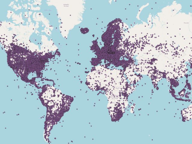
Unique content
Mapotic can offer hundreds of thousands of location data points
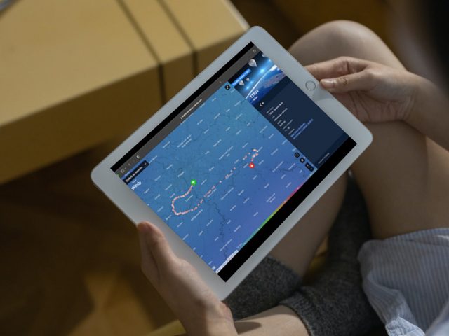
Mobile apps
Besides web outputs, clients can easily build their own branded maps mobile app
Get Inspired
Get inspired by globally respected organizations that have already joined Mapotic
Expats in Science
Map enabling connections between expat students around European cities
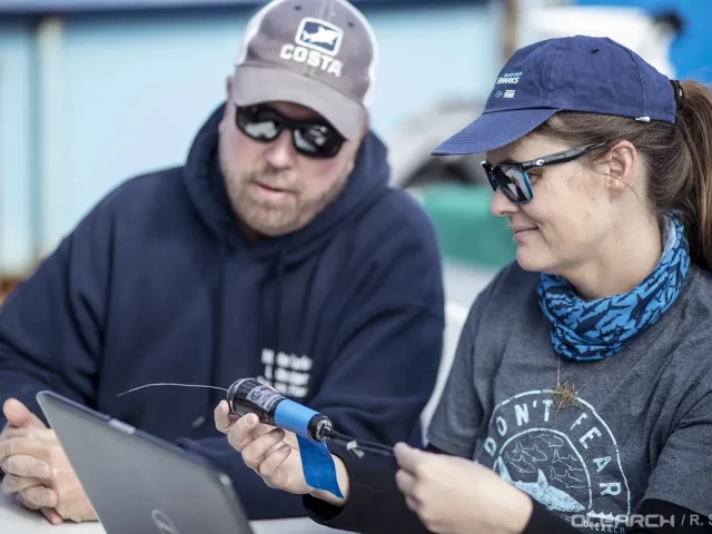
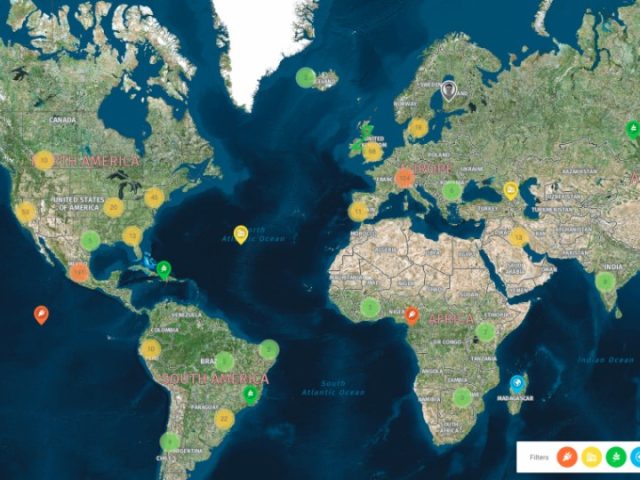
OCEARCH Shark Tracker
Tracking the movements of sharks is helping scientists restore the lost balance in our oceans.