Home » Mapotic blog » How to make a custom map in minutes
In today’s digital age, the ability to create a custom map is more than just a convenience – for many businesses and communities, it’s a necessity. Platforms like Google Maps are great for basic mapping needs (learn more in our article about Google My Maps Top Alternatives in 2023) However, they often fall short when you need more advanced features such as filters, data layers, adding sponsors or user interactions. That’s where custom map creation comes in. Mapotic’s map builder is designed to be useful and easy to use for everyone.
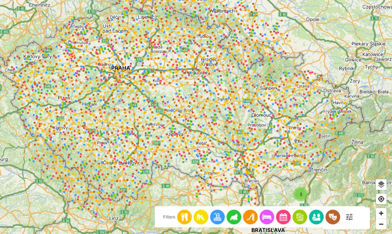
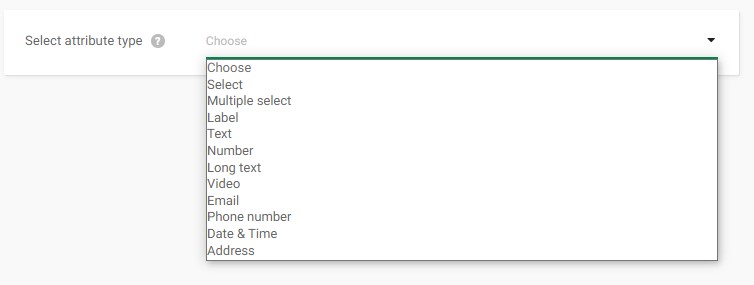
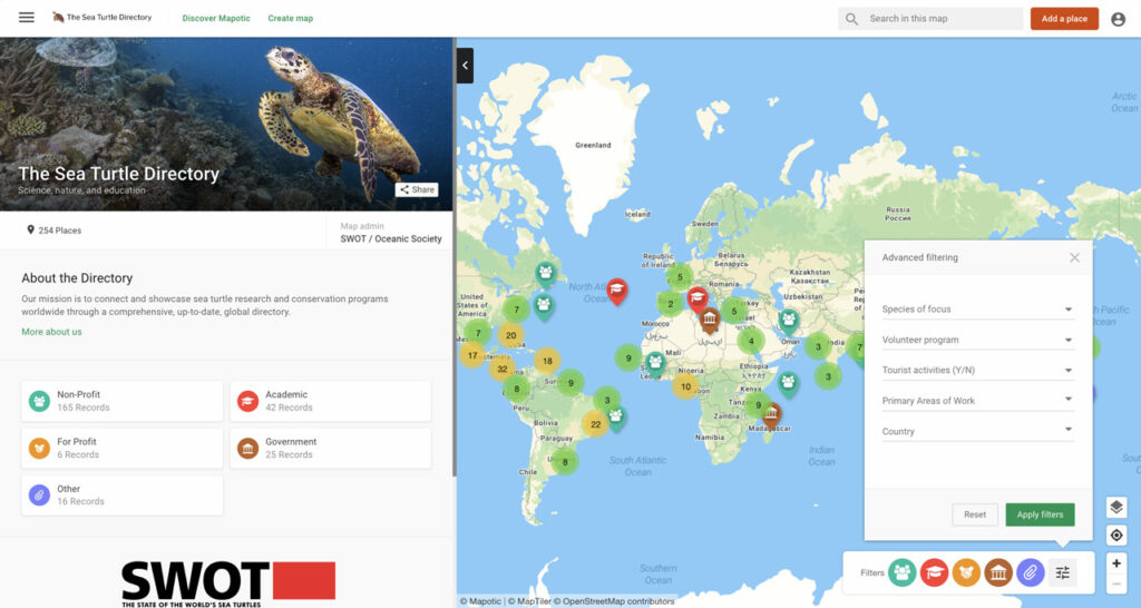
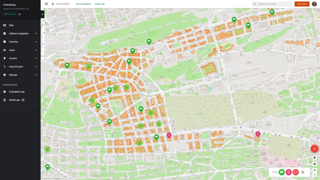
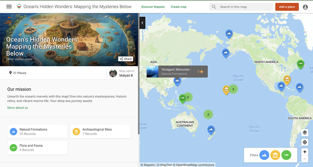
Beside user interactions, one of the outstanding features of Mapotic’s Map Builder is the customizability in map making process it offers. You can easily create custom fields and categories to suit the unique needs of your project. These custom attributes, such as ‘Select’ and ‘Multiple Select’, also generate filters to make your custom map user friendly.
These custom attributes will automatically generate filters on your map frontend. Map content filter will be generated from following fields: select, multiple select, label.
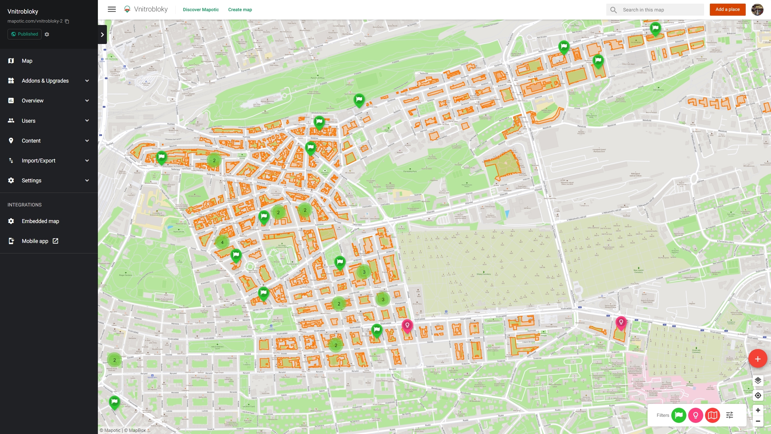
Map Builder does more than just pin places on a map. You can include different types of objects, polygons and custom routes. You can also include images, video or rich content in your places (routes, polygons), work with hidden or public custom fields in points of interest and much more. This diverse approach enriches your custom map-making experience.
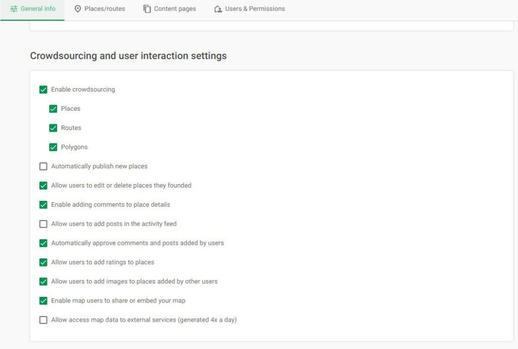
One of another key benefits of creating custom maps with Mapotic’s Map Builder is user engagement. You can give your custom map a collaborative edge by allowing community members to contribute to your map by adding comments, photos and even new locations.
The level of user content can be controlled through extensive options in the admin interface. You can choose whether locations, images, comments or ratings should be visible immediately or after administrator approval.
Mapotic integrates a number of map layers companies including following maptiles services. In your custom map creation process you can select satellite maps, vector or bitmap map tiles from range of providers:
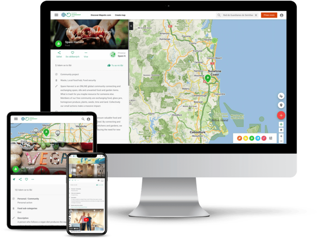
Whether your website runs on WordPress or another CMS, embedding your custom map is incredibly easy. Just paste the code snippet provided by Mapotic and effortlessly display your custom map on your website.
If your custom map gains traction and you want to expand, Mapotic’s Map Builder offers advanced features such as hosting your map on your own domain (Whitelabel) or launching a dedicated map based mobile application. These premium services take your custom map creation efforts to a professional level.
Map Builder is a smart, free custom map making tool that can get your project out in minutes or build a complex live data maps project with a mobile app in a matter of weeks.
Are you interested in taking your custom map making project to the next level? Contact us, and our team of geospatial data professionals will be more than happy to assist you.

Fahlo increases their sales and supports non-profits through interactive animal…
Community map MoveTheDate by Global footprint network connects sustainable projects…

Helping hundreds of students discover the frontiers of the cosmos.

Develop web or mobile tourism apps with updated, relevant datasets that inspire and offer unique experiences.

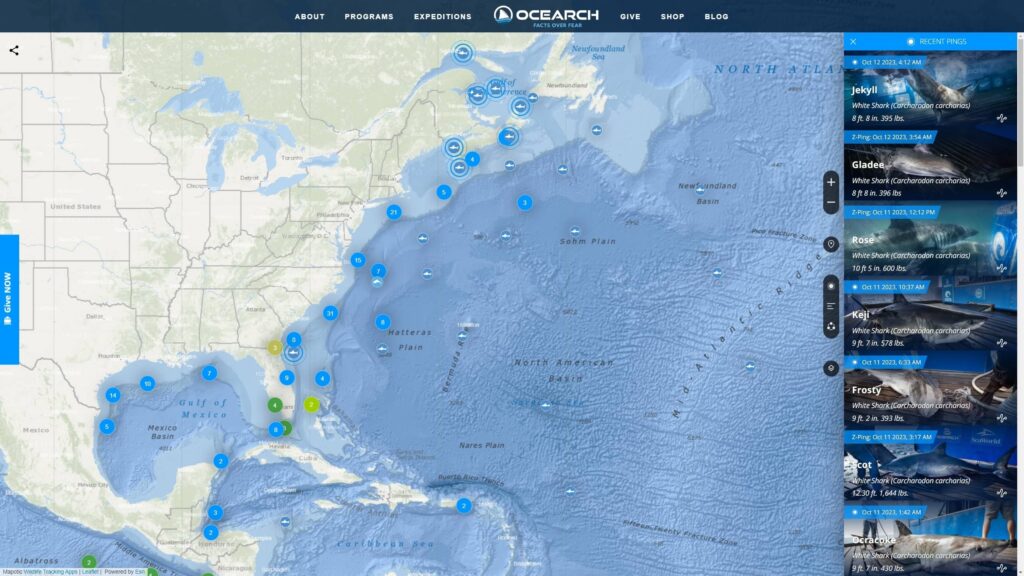
Support wildlife exploration and protection by providing wildlife tracking systems and tracker apps
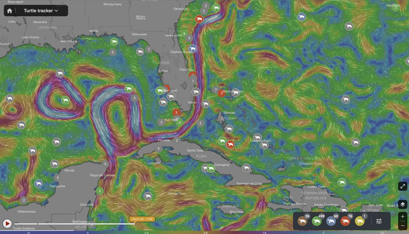
Drive environmental projects with our technology, merging data visualization and technology to balance human and nature interactions.

Build social impact projects to connect those in need with helpful resources, meaningful aid & community support.
Improve quality of life in public spaces through smart city development and active citizen feedback

Bridge people with shared missions through collaborative and community centered interactions