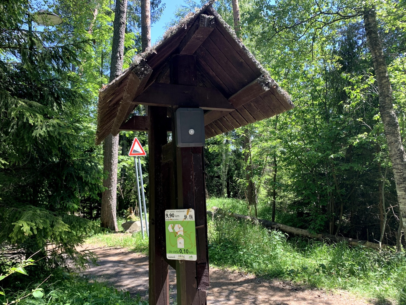
Mapotic typically focuses on mapping applications, visualising geolocation and IoT data on interactive maps. In 2022, we participated in an outdoor people counting project in the Tatra Mountains. Together with Hardwario and the High Tatras Tourism Association, the two companies successfully tested the concept of new IoT online people counters in remote areas. The key features are low-power devices for long-term monitoring, low-power networks that can provide constant connectivity from remote outdoor areas, and clever telemetry processing and visualisation of location data reports.
And to get boots on the ground, Mapotic is now entering into a strategic cooperation with Partnerství o.p.s. This organisation has been involved in the practice of counting systems for some time and is a leading figure in the Czech market. Hardwario will provide a comprehensive range of innovative, low-power, battery-based hardware with permanent connectivity. Partnerstvi will add robust installation experience and the Mapotic platform will provide attractive data visualisation, be it on maps, charts or apps and reports tailored to use cases based on customer needs.

“Our world is maps and dynamic location data aggregation and visualization over interactive, easy to consume maps. With the advent of modern IoT devices, we have the opportunity to fundamentally accelerate the deployment of counters in places where mains power is not possible and where it is difficult to communicate using standard GSM technologies. Partnerství supplies us with the necessary know-how, which is the basis for the correct deployment of the counters and the evaluation of the measured data. We decided to entrust the supply of innovative IoT battery meters and data transmission to a renowned player in this field, the Liberec company Hardwario. We now have a unique solution in our hands based on the CHESTER IoT gateway, which is easy to deploy and operate. And thanks to this, we can focus on data processing, analysis and visualization that will help organizations get information about the movement of people and other means of transport in a variety of locations, such as city-centers and remote places.” says Ivoš Gajdorus, CEO of Mapotic.

“Our cooperation with the Mapotic team started with a pilot project in the High Tatras. In difficult conditions, we have jointly verified that our solution is more than competitive and will enable a significant expansion of census technology in our country and worldwide. Our long-standing partnership will benefit all three companies, and especially cities and municipalities, which will finally be able to make decisions about transport and tourism development over data,” adds Alan Fabik, co-founder of Hardwario.
Who are they?
A Czech technology company that focuses on IoT – Internet of Things. It provides its customers with configurable IoT devices, connectivity and cloud services. Together with its partners, it successfully implements IoT projects in manufacturing, energy, agriculture, retail, healthcare and asset management. For more detailed information, please visit Hardwario website.
A non-profit company dedicated to the development of environmentally friendly forms of tourism and traffic calming. It monitors cyclists and pedestrians using automatic counters, providing data important for planning the capacity of cycle and pedestrian routes. For more information, visit Partnerství website.