Samarra Archaeological City
UNESCO Map
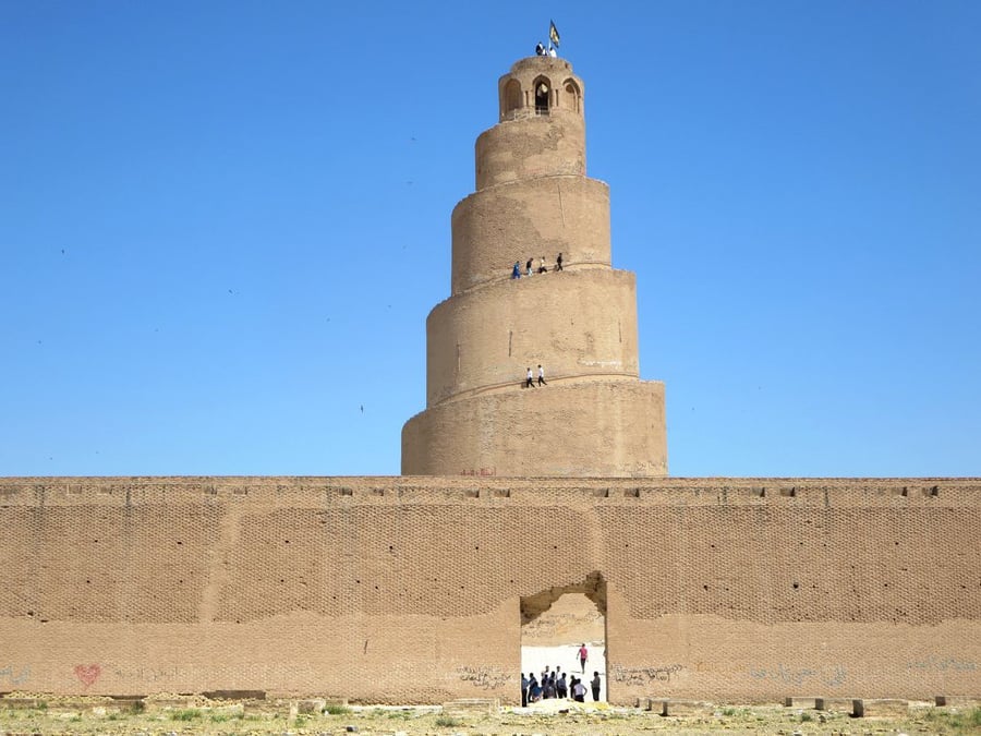
Description: Samarra Archaeological City is the site of a powerful Islamic capital city that ruled over the provinces of the Abbasid Empire extending from Tunisia to Central Asia for a century. Located on both sides of the River Tigris 130 km north of Baghdad, the length of the site from north to south is 41.5 km; its width varying from 8 km to 4 km. It testifies to the architectural and artistic innovations that developed there and spread to the other regions of the Islamic world and beyond. The 9th-century Great Mosque and its spiral minaret are among the numerous remarkable architectural monuments of the site, 80% of which remain to be excavated.
Date inscribed: 2007.0
Area in hectares: 15058
Category specified: Cultural
State: Iraq
Region: Arab States