Hadrian's Wall - Maia Roman Fort
Under your feet
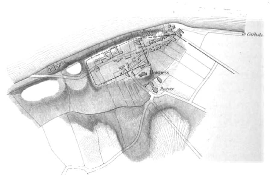
Description: https://en.wikipedia.org/wiki/Mais_(Bowness)
Descripcion foto: Maia, or Mais, was a Roman fort on Hadrian's Wall, and was the last (or first) fort at the western end of the Wall, overlooking the Solway Firth. It is believed to have measured 710 feet (220 m) by 420 feet (130 m), making it the second largest fort on the Wall. Little is known of the garrison, but its third-century commander was a tribune, indicating that it was probably a thousand-strong (military) cohort of infantry, perhaps part-mounted.
Website: https://commons.wikimedia.org/wiki/File:Lageskizze_MK_80.png
Completado?: Y
Fecha: 2nd Century
Copyright: Henry McLauchlin, um 1857, Public domain, via Wikimedia Commons
Comments
Under your feet was created by Free Custom Map Builder that powers thousands of custom online maps.
Want to build own custom map for your business or community? Try Mapotic's custom map maker and create customizable or branded maps in minutes. Leverage filters, custom categories, crowdsourcing and SEO. Create a free custom map.