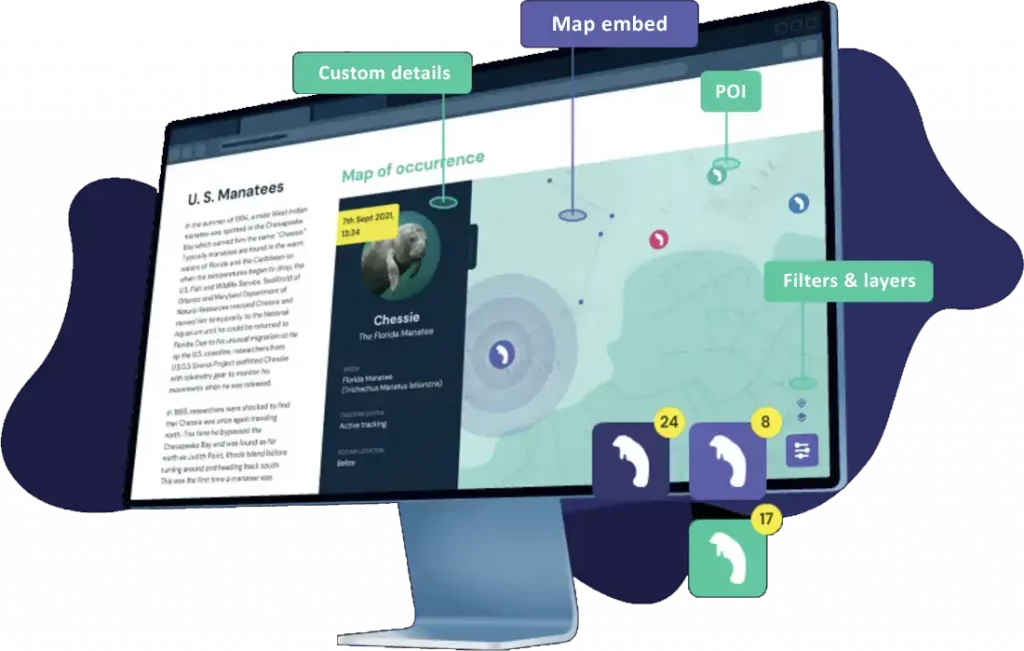
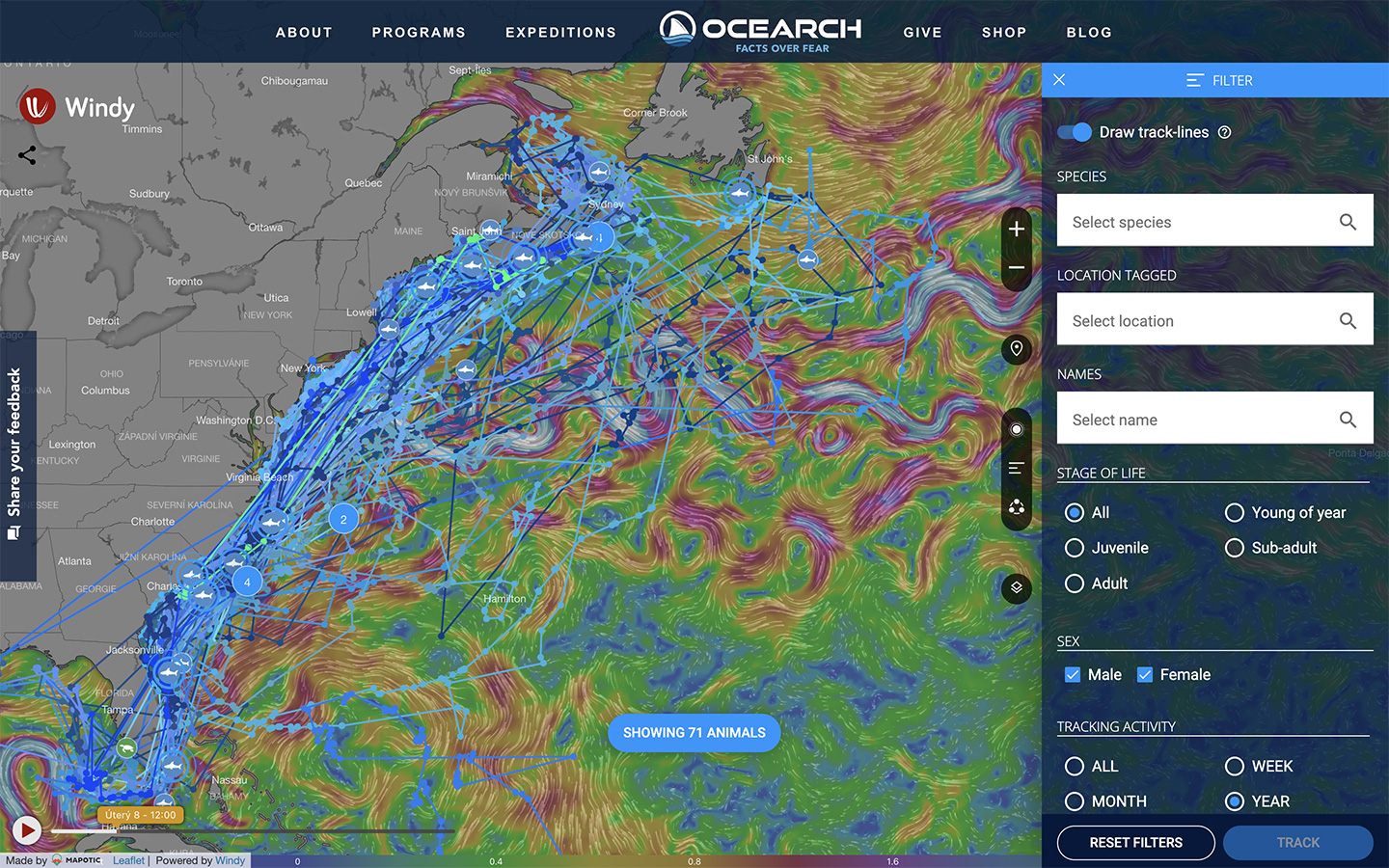
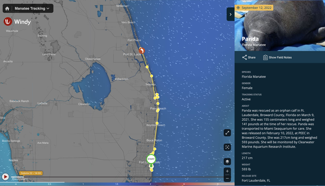
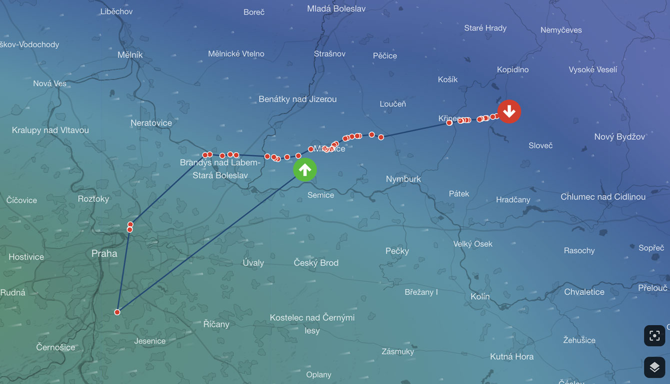
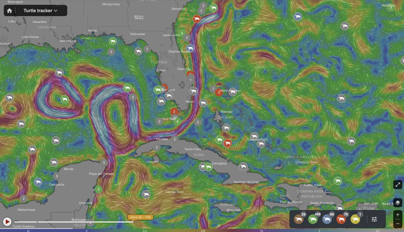
With Mapotic you can do more than just display the current position of tracked objects – you will be able to visualise routes, analyse motion history and present data on your own website or mobile application.
Work in a sophisticated manner with the data that is generated by tracking devices. Don’t settle for displaying the current locations – utilize all data with Mapotic.
You can process, normalize and add other relevant information to Mapotic Tracking Data before further visualization. You can then display them for internal use or for your audience.
Efficiently use tracking data. Thanks to built-in filters and flexibility you can: filter the data, add more information to the same map project, perform analyzes or set alerts and notifications, etc.
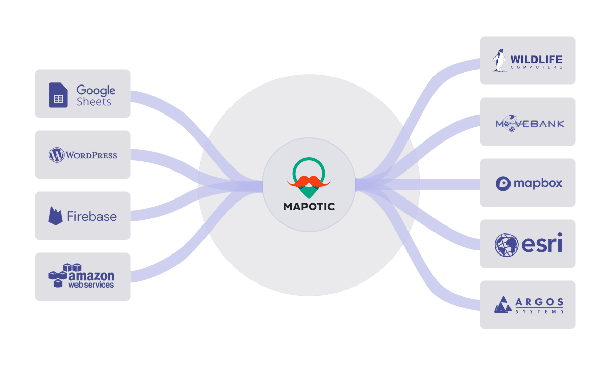
Mapotic connects to any data source and displays them in their original form or it is possible to alter them for further work. Whether conventional GSM devices, classic 2G / GPRS trackers, devices built on new technologies with NB-IoT or LORA connectivity.
Mapotic displays location data or other acquired information in the form of points on a map, grouping them into categories or further parameterizing them according to the tracker classification or acquired values. It uses the web or mobile applications for visualization.
If the set limit values are exceeded in the data, the system can be set to send notifications or alerts. You can further analyze all the data stored in the system, perform statistical analysis of location or tracking intelligence and achieve optimization of activities.
Mapotic originated as a community portal with the mission to support various projects. Therefore, interactive functions can be activated for the monitored data. It lets users comment on the movement of objects, vote or enrich the data with their own content.
Thanks to the bi-directional interconnection of the systems, Mapotic allows users to send data from the secure control panel to the device and change their settings or send them instructions.
Tracking wild animals, whether sharks, birds or wolves, is one way to use modern technology to understand animal behavior.
Monitoring company cars or trucks is common today. With new technologies, however, it can track:material, individual pallets or capacity of even a medium-sized carrier at a lower cost.
Tracking urban furnishings or movable property managed by a city or organization will help solve many difficulties. For example, in monitoring movement and analyzing public transport.
With industry 4.0 and the growth of IoT, permanent machine monitoring is becoming a common feature of the production manager. Location tracking of movable machines or a constant overview of material and employees.
Tractors are now commonly equipped with GPS. But what about trailers, semi-trailers and other agricultural machinery? With low power devices you can monitor all types of technology and have a constant overview of where the machine is working or parked.
Utilize Mapotic in a shared economy where you use vehicles and applications for dispatching or for end clients. Save time, and focus on the essence of your business.
GPS chips or the beginning Galileo are classic technologies used by each tracker for positioning. However, this position must be sent somehow, which was previously done via GSM (in areas with signal reception) or via satellite technology.
Now you can use the new NB-IOT network, LTE Cat M1 or more community-oriented LoRa. Each is suitable for a different type of use.
Trackers or tracking devices
There are a huge number of trackers on the market. Depending on what you need to track it is necessary to choose the right technology, not only in terms of HW but also in terms of connectivity. The key questions are: Where can the tracker send your data and how is it connectable to other systems? Most IoT devices send data to collection hubs that have an easy-to-connect API.
Global assistance is an assistance company providing services for motorists throughout Europe.
European structural and investment funds Operation programme Prague – Growth Pole Czech Republic.