Forest 44 Conservation Area
Environmental Science Final
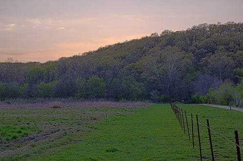
Description: Forest 44 Conservation Area, consisting of 998 acres of land, is located in western Saint Louis County, near the town of Valley Park and Interstate 44. Before its purchase by the Missouri Department of Conservation from the heirs of Reinken Estates in 1990, Forest 44 was a cattle ranch that spanned 10,000 acres. There are trails of 2.2 miles & 11.8 miles, a shooting range, 914 of forest, and 44 acres of grassland. At the conservation area, you can hike, horseback ride, bike, and hunt/fish with a permit. Young dogwood and redbud trees are scattered throughout the area, with the eastern portion of the land feeding into Williams Creek.
Address: 38°31′26.27″N 90°31′42.28″W
Website: https://web.archive.org/web/20120608113521/http://mdc4.mdc.mo.gov/applications/moatlas/AreaSummaryPage.aspx?txtAreaID=9023
Comments
Environmental Science Final was created by Free Custom Map Builder that powers thousands of custom online maps.
Want to build own custom map for your business or community? Try Mapotic's custom map maker and create customizable or branded maps in minutes. Leverage filters, custom categories, crowdsourcing and SEO. Create a free custom map.