Attribute as a tool for displaying information in a structured way
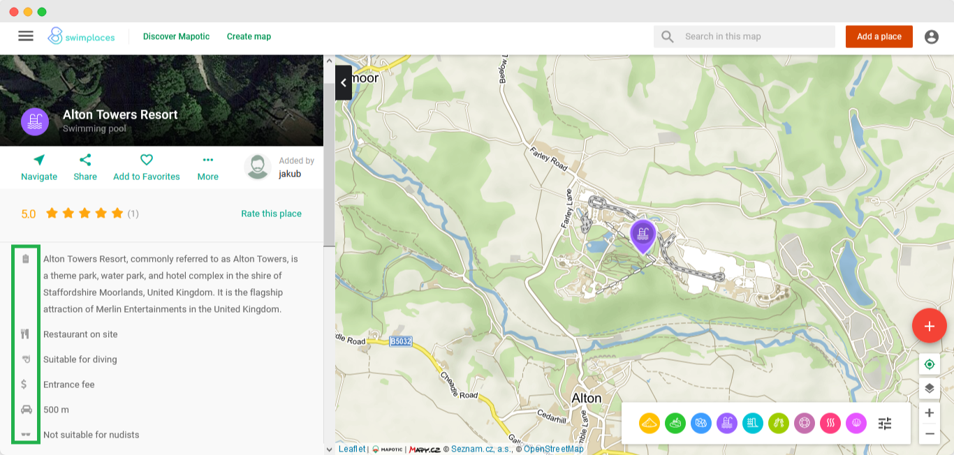
The Swimplaces map offers multiple pieces of information to help its users to decide where to go to take a swim. In addition to the locality and the name of the place, it also shows whether swimming is free, whether you must pay (Admission/No admission option), how far the closest parking is (selection from several numeral options), etc.
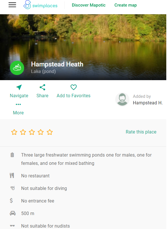
Attributes help specify the characteristics of the place.
Did you know that you can also use attributes to create useful filters for your map?
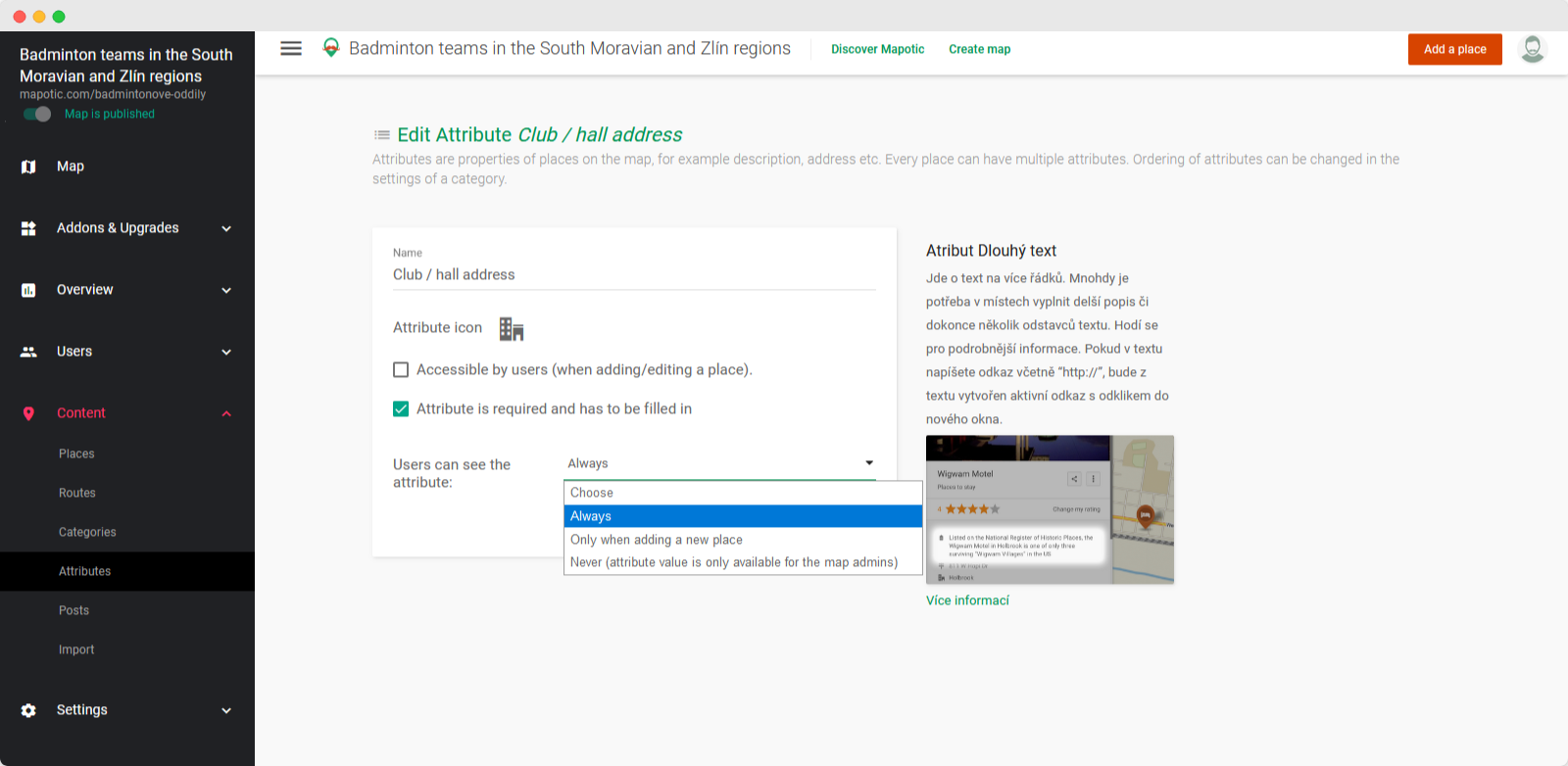
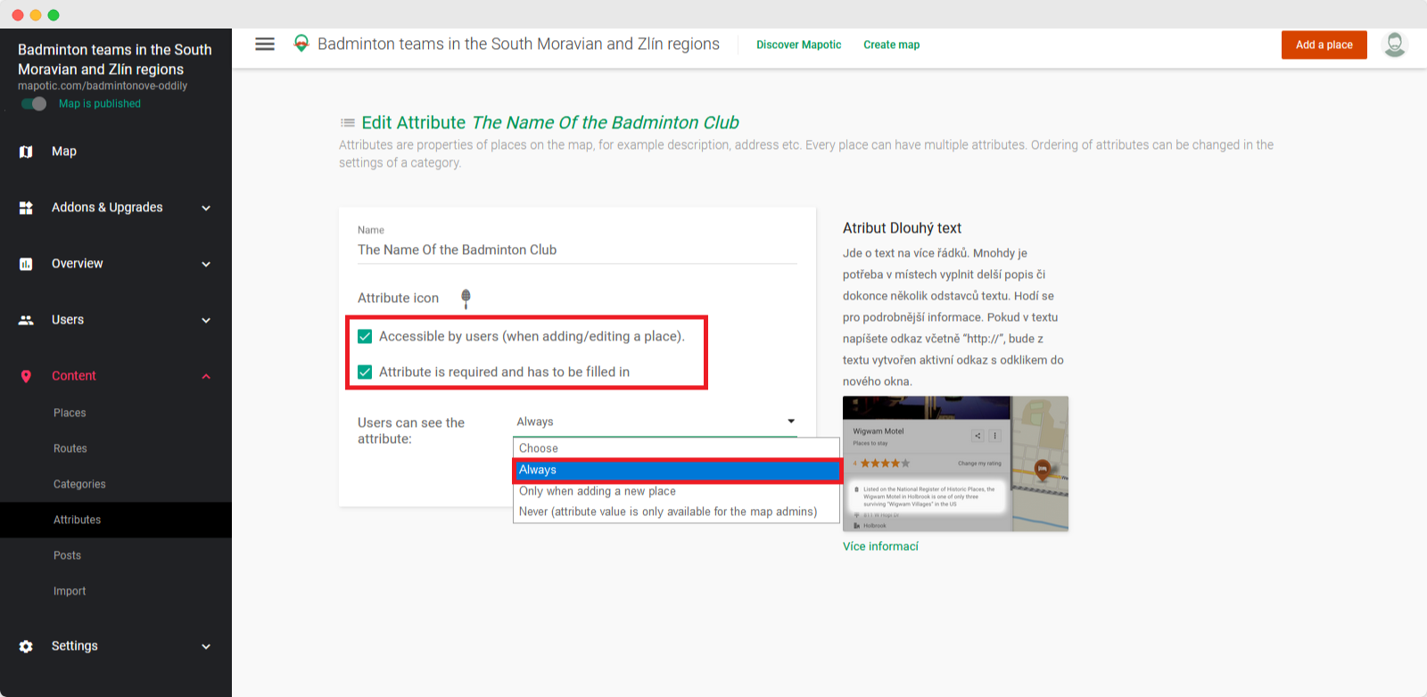
2. Attribute with visibility “ONLY WHEN ADDING A NEW POINT”
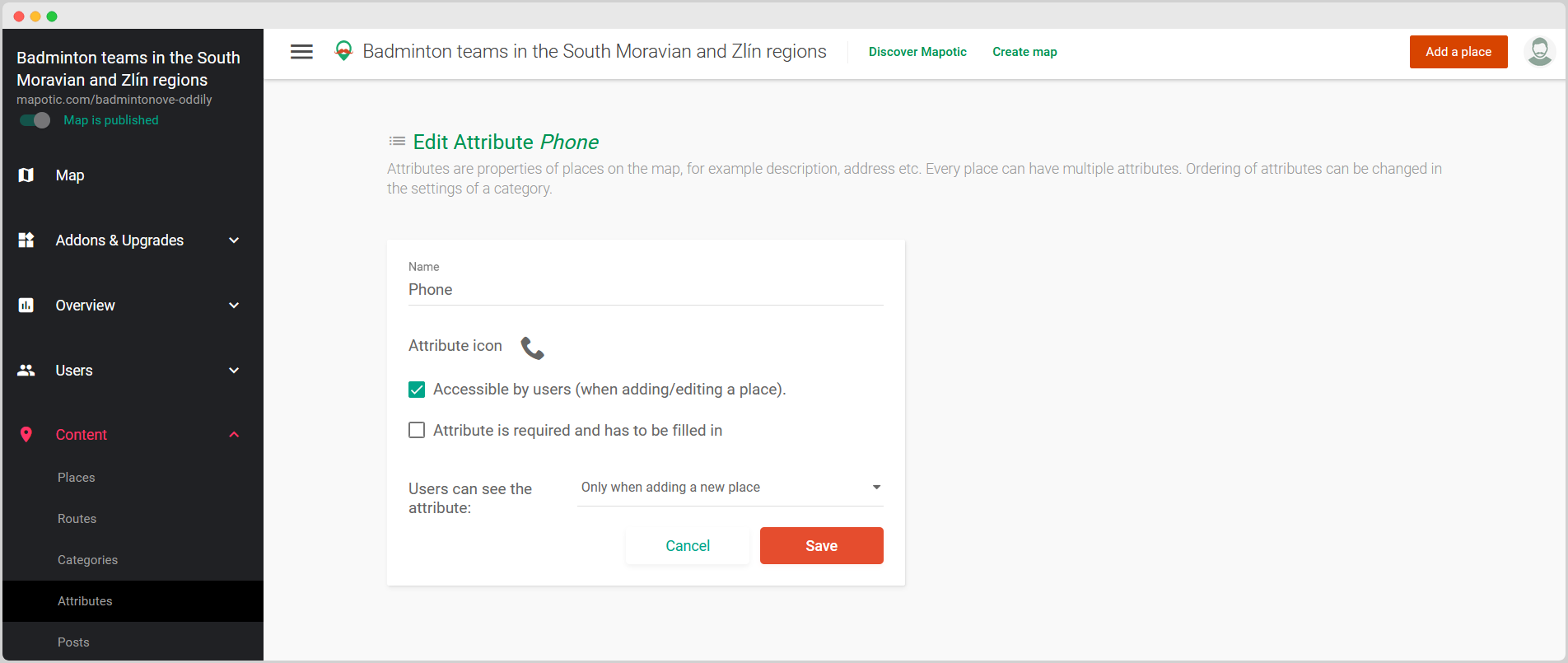
- Is used to pass certain information over to the map administrator when adding a new place.
- It will only be seen by the registered user who enters the place on the map. Once the added place is approved, other map visitors will not see the attribute in the place detail at all.
- Map administrators have access to the filled value of this attribute in the administration panel (Content -> Places).
This setting of the Phone Number attribute allows private information to be passed on to the map administrator
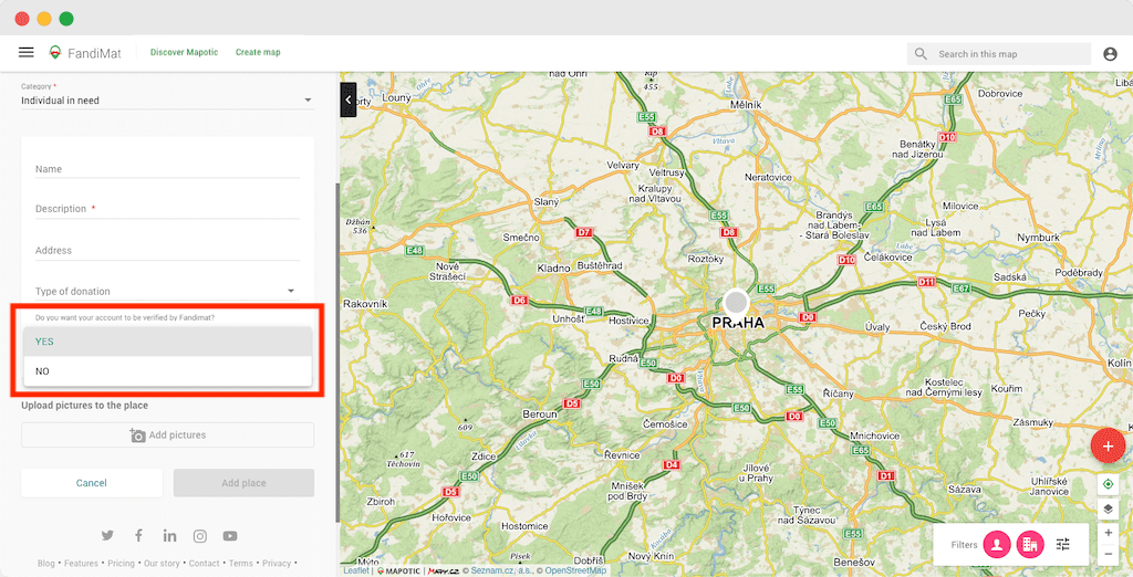
An attribute as a tool for a user to pass specific information on to a map administrator
This type of visibility is used, for example, by users of the FandiMat map that mediates contact between people in need with those who offer material support.
When creating a new point on the map, these users can use the hidden attribute to notify the map administrator that they are requesting verification of their account by FandiMat. The aim of this step is to increase the credibility of the applicant in order to increase his chances to get material support. If the result of the check is correct, the map administrator will assign the place a “Verified by FandiMat” badge (attribute). This is then visible to all potential donors and increases the credibility of the material support seeker. Users only have the option to request an account review when adding a new place, but not later.
Attribute with visibility ONLY WHEN ADDING A NEW POINT can be used e.g. if you want (as a map administrator) the users to provide you with private information when adding a new place to your map.
An attribute as a tool for map admins to store internal place-related information.
This function was widely used in the “masks” map of Dame Rousky, which was founded by volunteers from Cesko.Digital to help connect volunteers sewing face masks for people in need. The whole project was created in the hectic conditions of the booming COVID-19 epidemic. Yet, it was necessary to consider the legal aspect of the project. In order to provide contact information for the aid providers (volunteers who sewed masks, 3D shield printers, etc.) to other users of the map, it was necessary to obtain their consent to the processing of personal data (GDPR). If users registered themselves on the map, they could simply give consent themselves using the checkbox. However, a problem arose when users did not register for the map themselves, but “only” sent a request to the map administrators to add their service by email. Databases were created with lists of users who wanted to have “their” pin on the map, but their consent to the processing of personal data was missing. It had to be obtained additionally. So, the map admin created a point on the map and added information such as “Missing GDPR”, “Wrong email”, “We need to verify the capacity”, etc. Since the Dame Rousky map had more administrators, all these administrators were able to see this information.
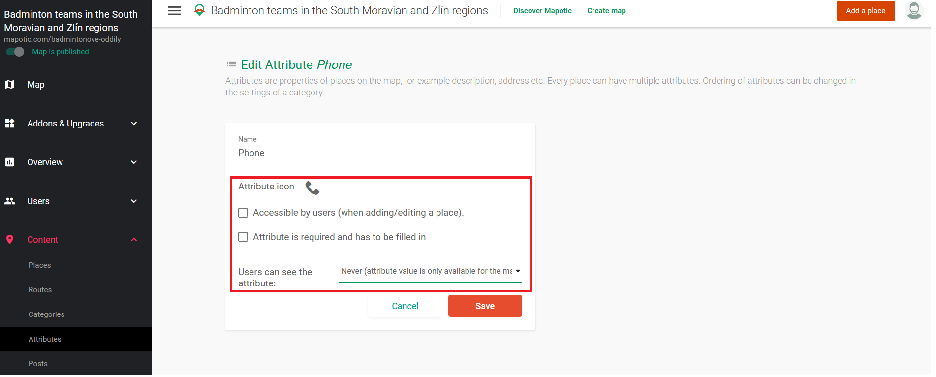
With this attribute setting, only you and other map administrators will see your “notes” or information. For example, a private contact to the hall provider